Xujiachong Fm
Type Locality and Naming
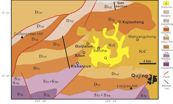
The type section is located near Xujiachong Village of Xishan Hill in Qujing County (103o 44'E, 25o 35'N), Yunnan. It was named by Zhang Xinping in 1966, who assigned it as a formation of Cuifengshan Gr.
Synonym: Xujiatun Fm
[Figure Simplified geological map showing the locations of the type sections of Xishancun Fm (D1 x), Xitun Fm (D1 xt,), Guijiatun Fm (D1 g) and Xujiachong Fm (D1 xj) of Cuifengshan Gr in the West Hill of Qujing City, Yunnan Province.]
Lithology and Thickness
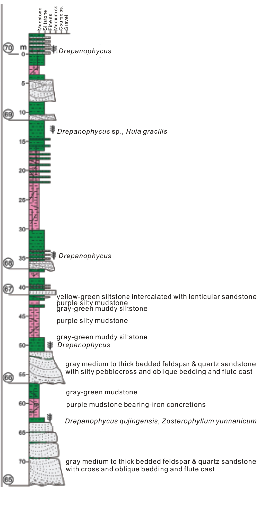
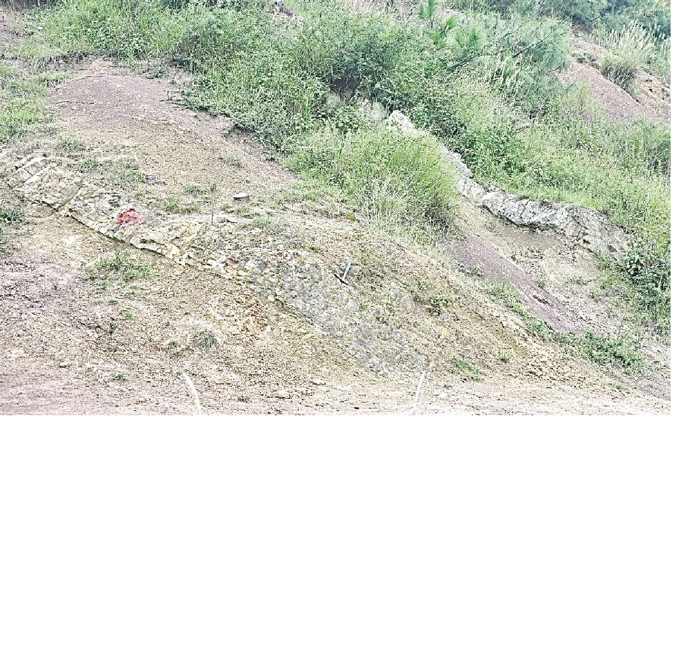
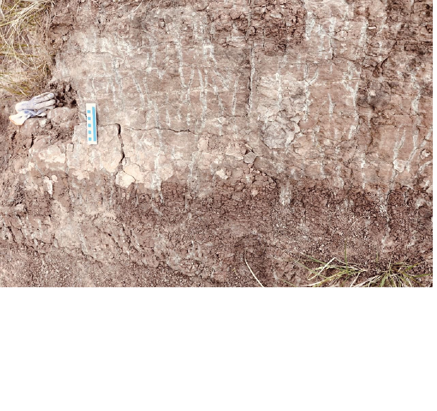
Sand-claystone cycles. The formation is dominated by purple-red, yellowish brown and gray green mudstones and muddy siltstones intercalated medium- to thick-bedded, fine to middle grained quartz sandstones, 841.84 m thick. It has been divided into 93 sedimentary cycles showing repetitive facies associations comprising a 4-unit structure cycles composed of basal conglomerates or pebble-bearing sandstone with washing level; gray white medium- to thick=bedded quartz sandstone with cross bedding, followed by gray green medium-thin bedded sandstones and siltstones, and, at the top, purple-red mudstones and ending with gray-green muddy siltstones. Plant traces preserved as sediment-filled casts, molds, and/or rhizohaloes occur in all lithofacies, but are most common in red and gray-green mudstone/siltstone paleosols. Red mudstone facies with abundant plant rhizome traces and some with scattered carbonate nodules, are classified as protosols or calcisols. Some beds of gray-green mudstone/siltstones also show plant traces and red mottling but lacking carbonate nodules.
[Figure Lithological columns of the Xujiachong Formation with representative sedimentary cycles. Cycle numbers, lithofacies, and fossil plants are based on Liu et al., 2004; Xue et al., 2016.]
[Figure Stratigraphic outcrops of Xujiachong Formation at Xujiachong of Qujing showing a typical 4-unit structure cycles.]
[Figure Purple-red mudstone with green vertical plant traces in the Xujiachong Formation at Xiaoguanko (courtesy of Xue Jingzhuang).]
Relationships and Distribution
Lower contact
It has conformable contact with the underlying Guijiatun Fm.
Upper contact
It is disconformable in contact with the overlying Chuandong Fm or Haikou Fm
Regional extent
It is mainly distributed in the Est of Yunnan at Xishan-Cuifengshan Hills area of Qujing County. Yunnan.
GeoJSON
Fossils
It yields Llant Zosterophyllum astralianum- Hedeia sinica Assemblage.; Spore Retusotriletes rotunda, Apiculiretusispora plicata Ass. and Verrucosisporites polygonalis-Dibolisporitestteldorfensis Ass., and Fish Sanchaspis magalarostra, Galespis xujiachongensis..
Age
Depositional setting
According to Xue et al. each sedimentary cycle of the formation is interpreted to represent a river channel migration or episodic crevasse splay followed by floodplain development.
Intraformational conglomerates, usually several centimeters thick, with abundant mud and some lithic clasts, are interpreted as basal lags of reworked floodplain deposits. Medium- to thick-bedded gray sandstones, subarkosic arenitic, and quartz arenitic in composition, with trough and tabular cross-bedding, ripple lamination, and erosional base, are interpreted as fluvial channels and are typically found at or near the bases of some cycles. Couplets of thin bedded sandstone and gray-green siltstone occur above medium-thick bedded sandstones or near the bases of some other cycles. Such heterolithic deposits provide strong evidence for deposition in a stabilized channel environment, as either laterally accreted point bars or crevasse splays. Red mudstones (paleosols) with plant traces subsequently developed as floodplain deposits. Some sedimentary cycles include red-bed paleosols 2 to 4 times thicker than other lithofacies in the cycle, indicating a considerable time of landscape stability. In such cases, the sequence represents a mud dominated, stabilized floodplain.
Additional Information


